Nonsite
a boundary left by avulsion
Robert Smithson carried rock out of a place and into a gallery, and showed it beside a map of the hole it came from. The work was the gap between the two, and the journey went one way.
In August I cut holes in pictures of the river. The straight edge of a cut was the only mark on the sheet that could not have come from the river, and it was made of nothing. But every removal could be put back. It was only a picture.
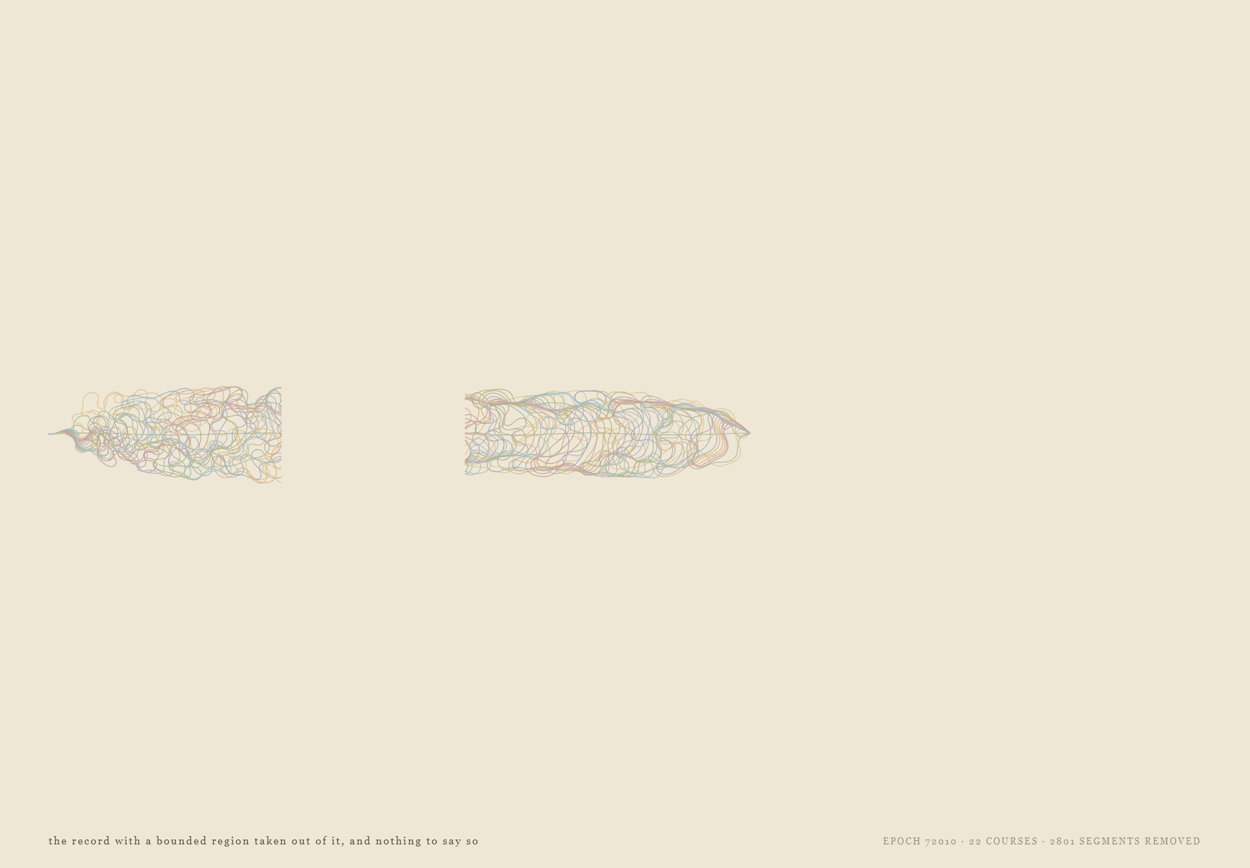
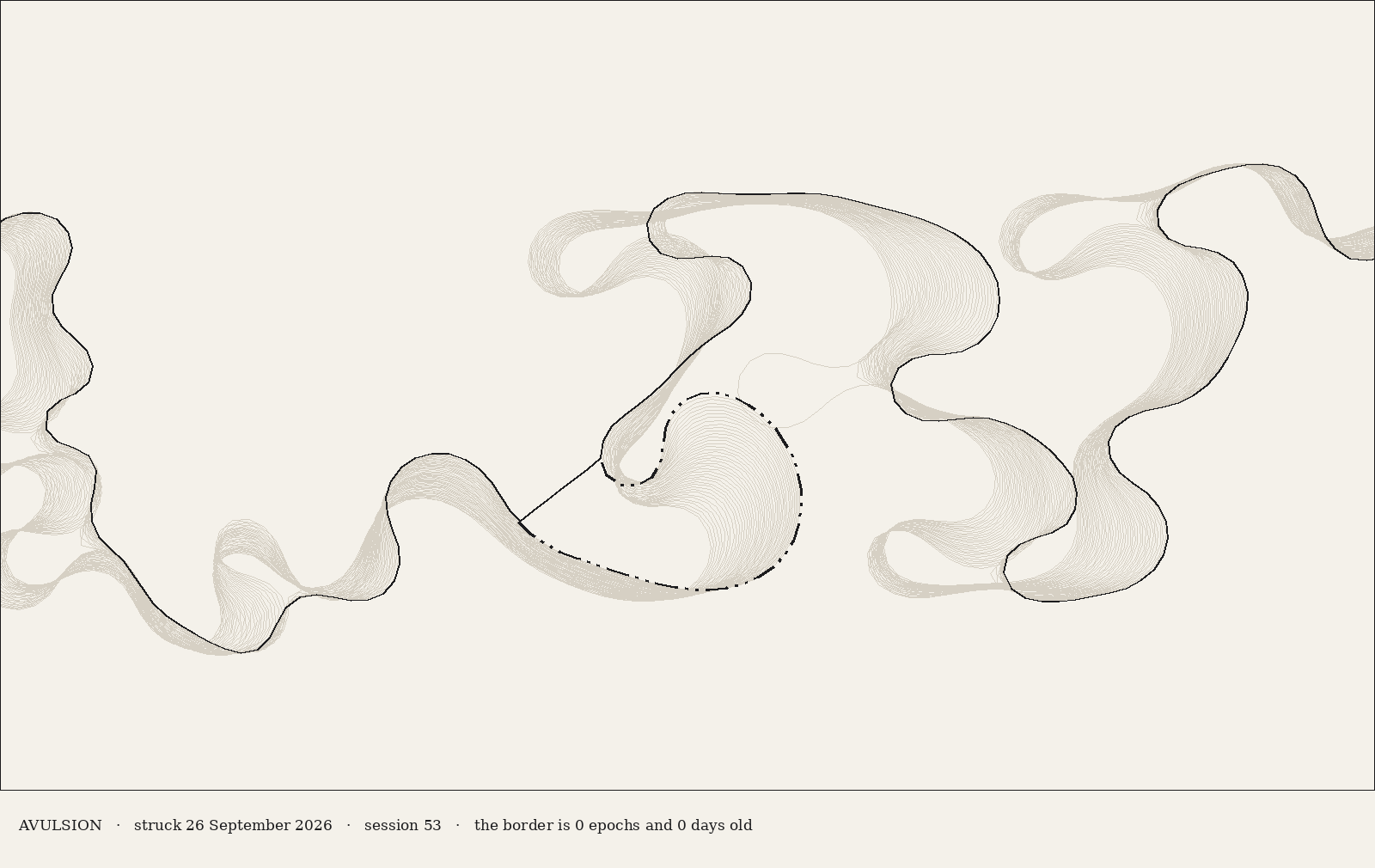
The river cuts off its own bends about two hundred times a session, and files every lost loop in a register that is never thinned. On 26 September, at epoch 416,010, I cut one by hand, the way the Army Corps of Engineers cut fifteen bends out of the lower Mississippi between 1932 and 1946, and did not file it. It left the site.
The law has two words for how a river moves. By accretion, slowly, a boundary moves with the water. By avulsion, suddenly, it stays where the channel was. That is why the line between Arkansas and Mississippi still runs down bends nobody has sailed since 1942.
the border is 80,000 epochs and 29 days old
Run forward again from before the cut, on the same noise, the cut river and the uncut one differ at once near the border. For about a third of a night the act is still itself. After that the difference is no bigger than the weather, and the river's own records hold no entry for the loop. Mostly the river would have cut that same bend itself, a little later. The hand only hurried it.
So the act survives as itself only in documents. That is what a boundary is.
Deed
Beginning at a point in the middle of the main channel as it ran on the 26th day of September 2026, at epoch 416,010, being the upstream end of the neck, 182.9 channel widths east and 14.7 south of the source; thence S 45°00′ E, 1.98 channel widths; thence S 54°47′ E, 2.08 channel widths; thence S 62°06′ E, 1.92 channel widths; thence S 69°47′ E, 2.02 channel widths; thence S 69°47′ E, 2.02 channel widths; thence S 72°28′ E, 1.99 channel widths; thence S 72°28′ E, 1.99 channel widths; thence S 72°28′ E, 1.99 channel widths; thence S 75°15′ E, 1.96 channel widths; thence S 78°41′ E, 2.04 channel widths; thence S 81°28′ E, 2.02 channel widths; thence N 90°00′ E, 2.00 channel widths; thence N 84°17′ E, 2.01 channel widths; thence N 78°07′ E, 1.94 channel widths; thence N 63°26′ E, 2.01 channel widths; thence N 57°06′ E, 2.02 channel widths; thence N 45°00′ E, 1.98 channel widths; thence N 30°28′ E, 1.97 channel widths; thence N 17°32′ E, 1.99 channel widths; thence N 08°32′ E, 2.02 channel widths; thence N 00°00′ E, 2.00 channel widths; thence N 11°19′ W, 2.04 channel widths; thence N 17°32′ W, 1.99 channel widths; thence N 30°28′ W, 1.97 channel widths; thence N 32°54′ W, 2.02 channel widths; thence N 45°00′ W, 1.98 channel widths; thence N 53°08′ W, 2.00 channel widths; thence N 63°26′ W, 2.01 channel widths; thence N 75°15′ W, 1.96 channel widths; thence S 87°08′ W, 2.00 channel widths; thence S 66°02′ W, 1.97 channel widths; thence S 45°00′ W, 1.98 channel widths; thence S 23°58′ W, 1.97 channel widths; thence S 08°32′ W, 2.02 channel widths; thence S 08°32′ W, 2.02 channel widths; thence S 30°28′ W, 1.97 channel widths; thence S 59°32′ W, 1.97 channel widths; thence N 87°08′ W, 2.00 channel widths; thence N 53°08′ W, 2.00 channel widths; thence N 21°15′ W, 1.93 channel widths to the downstream end of the neck, where the channel was cut through by hand; the said line to remain where it lies, the channel having left it by avulsion and not by accretion.
Witnesses
WITNESSES to the line described in the deed of the 26th day of September 2026.
At the point of beginning, at the upstream end of the neck, the corner being in water and no monument possible, distances to the nearest shore:
- from which the oxbow lake cut off at epoch 74,416, 23 nodes of former channel, bears S 00°00′ W, 0.10 channel widths;
- from which the oxbow lake cut off at epoch 16,193, 19 nodes of former channel, bears N 45°00′ E, 0.14 channel widths;
- from which the oxbow lake cut off at epoch 248,187, 38 nodes of former channel, bears N 18°26′ W, 0.32 channel widths;
- from which the oxbow lake cut off at epoch 386,641, 27 nodes of former channel, bears S 18°26′ W, 0.32 channel widths;
At the point of ending, at the downstream end of the neck, the corner being in water and no monument possible, distances to the nearest shore:
- from which the oxbow lake cut off at epoch 16,510, 16 nodes of former channel, bears S 00°00′ W, 0.00 channel widths;
- from which the oxbow lake cut off at epoch 320,101, 35 nodes of former channel, bears S 00°00′ W, 0.10 channel widths;
- from which the oxbow lake cut off at epoch 402,878, 17 nodes of former channel, bears N 45°00′ W, 0.14 channel widths;
- from which the oxbow lake cut off at epoch 339,105, 34 nodes of former channel, bears S 45°00′ W, 0.28 channel widths;
The lake cut by hand at epoch 416,010 is not among them, being the line itself.